

You can find on this page the Iceland cities map to print and to download in PDF. The Iceland map city presents main cities, towns and presents the capital of Iceland in Northern Europe.

The map of Iceland with cities shows all big and medium towns of Iceland. This map of cities of Iceland will allow you to easily find the city where you want to travel in Iceland in Northern Europe. The Iceland cities map is downloadable in PDF, printable and free.
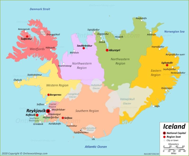
Iceland Cities and Towns as you can see in the Map of Iceland with cities: Akranes, Akureyri, Arnarstapi, Blonduos, Bolungavik, Bordeyri, Borgarnes, Budardalur, Budir, Dalvik, Djupivogur, Egilsstadhir, Eskifjordhur, Flateyri, Grindavik, Grundarfjordur, Hafnarfjordhur, Hella, Hellissandur, Hnifsdalur, Hofdhakaupstadhur, Hofn, Holmavik, Husavik, Hvammstangi, Isafjordhur, Keflavik, Kopavogur, Neskaupstadhur, Olafsfjordhur, Olafsvik, Raufarhofn, Reykjavik, Sandgerdhi, Saudharkrokur, Selfoss, Seydhisfjordhur, Siglufjordhur, Stokkseyri, Stykkisholmur, Sudhavik, Sudhureyri, Thingeyri, Vatneyri, Vestmannaeyjar, Vik, and Vopnafjordhur.
Hafnarfjörður in southwest Iceland is the hub of Viking culture. The city hosts an annual Viking festival, and it is where enthusiasts of the settlers visit to indulge in the culture since it is one of the oldest towns on the island. There are many unique activities available in Hafnarfjörður, from hidden world tours and horseback riding tours to trips to see traditional Icelandic costumes. The northern Icelandic city of Akureyri is a lovely fishing village, with roots that date back to the 9th century when Norse Vikings settled the area. It is fun to walk through Akureyri on Kaupvangsstræti, the main street that curves through town. If you cannot pronounce it, just ask the locals to point you in the direction of Art Street, which it is also called. The small city of Seyðisfjörður as its shown in the Map of Iceland with cities, is on a fjord on the eastern side of Iceland. It is one of the best places to visit if you want to see puffin colonies that inhabit the remote regions of Iceland. There is rich Icelandic culture and stunning natural beauty in Seyðisfjörður, as it is surrounded by mountains and shoreline.
The city of Egilsstadir as its mentioned in the Map of Iceland with cities, on the east end of Iceland, is easily accessed from the Ring Road, and it has a small regional airport, so flights are easy to take here from Reykjavik. The city is surrounded by beautiful landscapes, from mountains and waterfalls to glaciers and farmland. The far northwest city of Ísafjörður is the largest municipality in the Westfjords peninsula. It is accessible by car, and there are flights to Ísafjörður from Reykjavik if you do not want to navigate the roads, which can be dicey in the winter months. The town has roots in the fishing industry, and it is still an important part of the economy in the area. The charming fishing village of Hofn on Iceland southeast coast is a tranquil town with glacial lagoons surrounding it. Hofn is close to the Vatnajökull glacier, the largest in Europe. Just off the coast from Hofn are smaller islands that add to the seaside backdrop of this quiet and picturesque area.
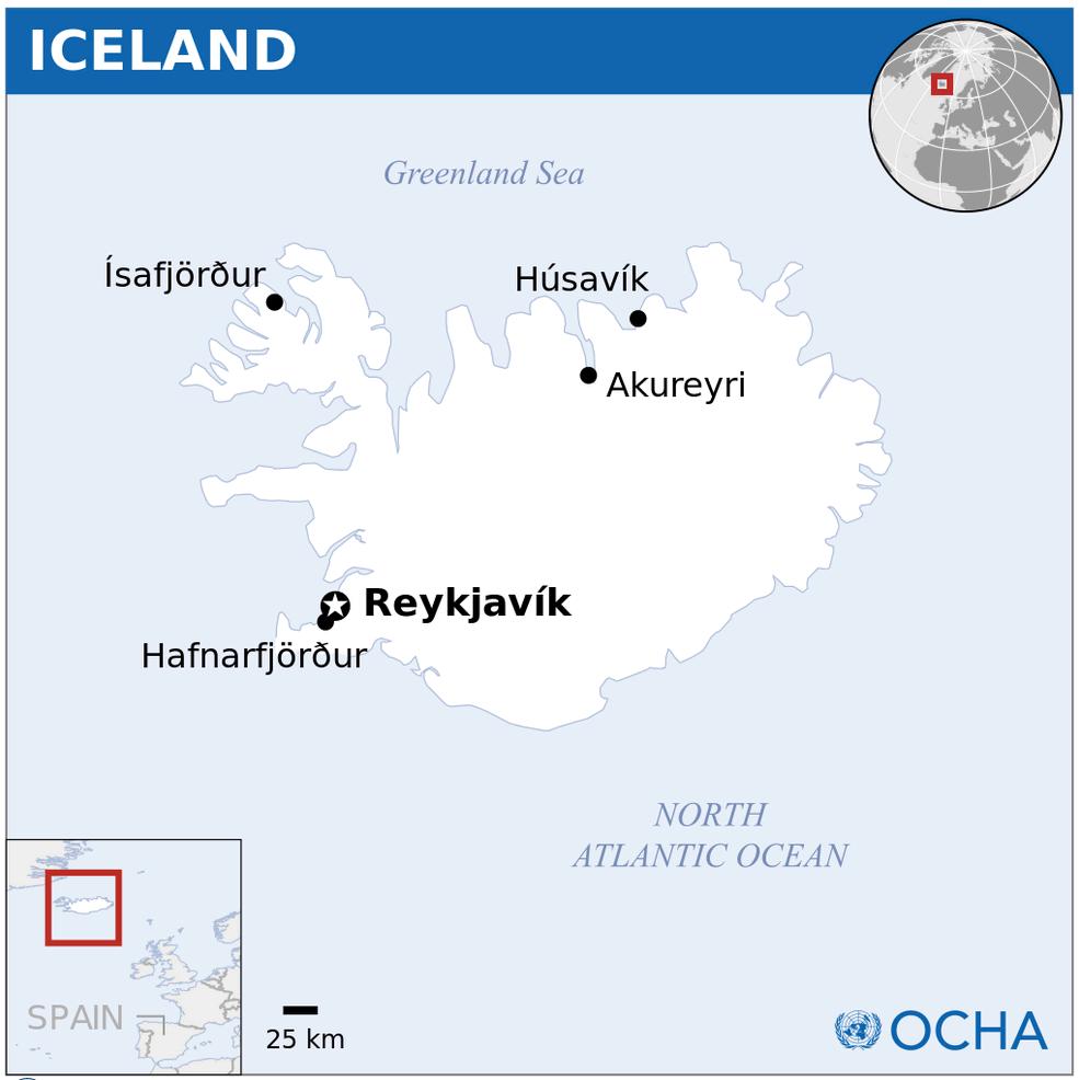
The map of Iceland with major cities shows all biggest and main towns of Iceland. This map of major cities of Iceland will allow you to easily find the big city where you want to travel in Iceland in Northern Europe. The Iceland major cities map is downloadable in PDF, printable and free.
Reykjavik is Iceland capital and houses over two-thirds of the population as you can see in the Map of Iceland with major cities. It is a colorful city with an interesting history and quirky side streets. Its main shopping and restaurants street is Laugavegur in the postal code 101 but all around it you can find hidden gems. Reykjavík main attractions are its swimming pools, Hallgrímskirkja Church, Harpa Concert Hall, the Grandi District, the city pond and the world-famous hot dog stand, Bæjarins bestu. Kópavogur is a town in Iceland located within the capital region right next to Reykjavik. It is known for its beautiful bay which gives the town its name ‘Baby Seal Bay’ and for being a nice and relaxed family town. Some of the most interesting places to visit in Kópavogur are the swimming pools, Kópavogslaug and Salalaug, the mall Smáralind and Gerðarsafn – Kópavogur Art Museum. If you are looking for a cheaper accommodation Kópavogur is a good option as the ride to Reykjavík is only about 15 minutes, you can easily catch the bus (in Icelandic Strætó) or drive your rental.
The third major city is Hafnarfjörður, most commonly linked to being the town of lava, elves and Vikings. It is also located within the capital region but it is the westernmost point of the region. Hafnarfjörður as its shown in the Map of Iceland with major cities is a vibrant village with a great town center with shops, restaurants and cafés. Basically, anything you might need and locals are known to leave the town as little as possible. Some great things to check out in Hafnarfjörður are the local swimming pools, the best being Suðurbæjarlaug, the excellent restaurants and cafés, Pallette, Brikk and Tilveran and the heritage museum Sívertsenhúsið. Reykjanesbær is the first municipality on the list but the most recognized area is the town of Keflavík, the one that the international airport takes its name after. Once having landed at Keflavík airport Reykjanesbær is the first settlement you will see and is really a great place to spend the first night or last before your flight.
Akureyri is located far away from the Reykjavík but it is often named the capital of the North as its mentioned in the Map of Iceland with major cities, stating its significance and size compared to the other settlements in the North. It is a town of history, of arts, of skiing, of amazing cuisine and of Brynja ice cream, the best in the biz. Akureyri is one of those towns you can visit over and over again and still manage to discover something new and see it in a totally new light. It plays an important part in Iceland history and has been a trading post for centuries. Garðabær is the town between Hafnarfjörður and Kópavogur, still located within the capital region. It is known for its extravagant houses and being home to some of the richest people in Iceland. Just recently the locals have started opening up restaurants and cafés with delicious food but it isn’t long ago that the only place to get a restaurant meal in Garðabær was in IKEA.
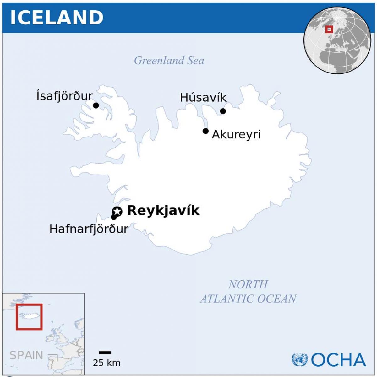
The capital of Iceland map shows the main city of Iceland. This capital map of Iceland will allow you to easily plan your travel in the capital of the country Iceland in Northern Europe. The capital of Iceland map is downloadable in PDF, printable and free.
Reykjavík (Icelandic pronunciation: [ˈreiːcaˌviːk]) is the capital and largest city in Iceland. Its latitude, at 64°08' N, makes it the world northernmost capital of a sovereign state. It is located in southwestern Iceland, on the southern shore of Faxaflói Bay as you can see in the Capital of Iceland map. With a population of around 120,000 (and over 200,000 in the Greater Reykjavík Area), it is the heart of Iceland economic and governmental activity. Reykjavík is believed to be the location of the first permanent settlement in Iceland, which Ingólfur Arnarson is said to have established around 870 C.E. Until the 18th century, there was no urban development in the city location. The city was founded in 1786 as an official trading town and grew steadily over the next decades, as it transformed into a regional and later national centre of commerce, population, and governmental activities.
The City Council governs the city of Reykjavík according to law number 45/1998 and is directly elected by those aged over 18 domiciled in the city as its mentioned in the Capital of Iceland map. The council has 15 members who are elected using the open list method for 4 year terms. The council selects members of boards, and each board controls a different field under the city council authority. The most important board is the City Board that wields the executive rights along with the City Mayor. The City Mayor is the senior public official and also the director of city operations. Other public officials control city institutions under the mayor authority. The Independence Party had overall control of the city council from the party establishment in 1929 until 1978, when they narrowly lost their overall majority. From 1978 to 1982 the People Alliance, the Social Democratic Party and the Progressive Party formed the majority of the council.
Reykjavík is the largest and most populous settlement in Iceland. Present-day Reykjavík is a multicultural city with people from at least 100 countries as its shown in the Capital of Iceland map. The most common ethnic minorities are Poles, Filipinos, and Danes. In 2009, foreign-born individuals made up 8% of the total population. Children of foreign origin form a more considerable minority in the city schools (as much as a third in places); many of whom are adopted. Although in addition to immigrant inhabitants, the city is visited by thousands of tourists, students and other temporary residents weekly, at times outnumbering natives in the city-centre; tending to be educated upper middle-class Scandinavians, Europeans, North Americans, or Japanese. Reykjavík is divided into 10 districts.